
I had a really great paddle this past weekend, out of the Inwood Canoe Club to to East River, east of Hell Gate. Led by the capable MH, our group also included AA, MD, IB, and LL, paddling a Tempest 170, a skin-on-frame boat, a Tercel, and Looksha IV respectively. MH paddled his canoe and I was in the Argonaut.
Our route took us down the Harlem River to Randalls Island, where we cut across along the Bronx Kill. A “kill” is a Dutch word meaning creek, and the NYC area is dotted with them: Arthur Kill, Kill Van Kull, and many more. The Bronx Kill is a narrow creek separating Randalls Island from the Bronx. After passing through it, we paddled around the Brother Islands, and then returned the way that we came.
While we didn’t pass through Hell Gate, this was a bit more of an adventure than I had anticipated.
The biggest challenge in this trip was to work out the tides. While I did plenty of research, I relied on MH to figure out where we needed to be and when. The tricky part is the relationship of tides flowing from the East River into the Harlem, and how they flow through the Bronx Kill.
As tide surges in (flowing west) from the harbor to Long Island Sound, current ramps up quickly through Hell Gate, flowing around Randalls Island, and splitting into the rest of the East River and the Harlem River. We wanted to make sure we had current with us flowing south on the Harlem and east on the East River heading out, and the reverse on the way back. Based on all of this, we left around 1300 and returned by 2000 – a later departure and arrival than we had hoped for, but acceptable.
We started from Inwood Canoe Club and paddled north, into now-familiar territory – past the railroad bridge at Spuyten Duyvil, around the corner past Peter Sharp Boathouse, and on down to High Bridge. We spread out, each paddling at our own pace, and took a short break at High Bridge.
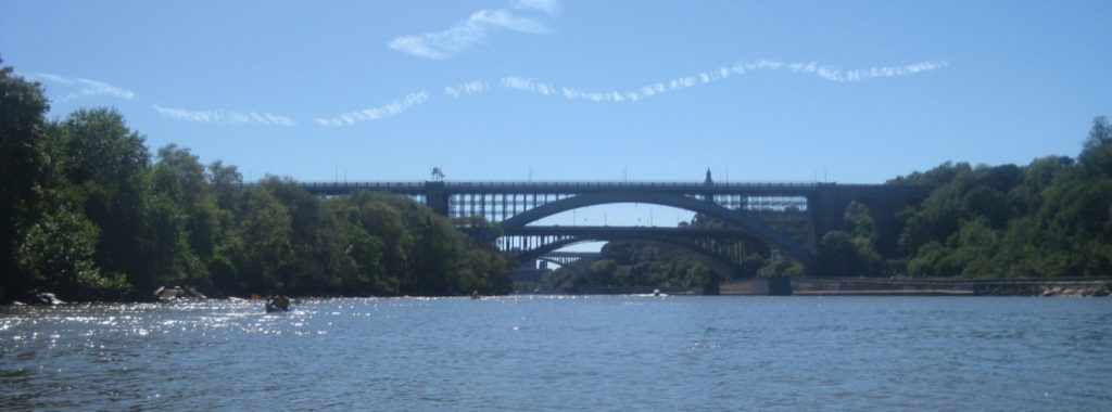
High Bridge is one of the oldest bridges in NYC. Originally part of the Croton Aqueduct, it was completed before the Civil War. It was originally a masonry bridge but later replaced with steel. It was a pedestrian bridge until the 1970s, closed after someone supposedly hurled a rock at a tour boat from it. It is recheduled to re-open to pedestrian traffic in 2013.
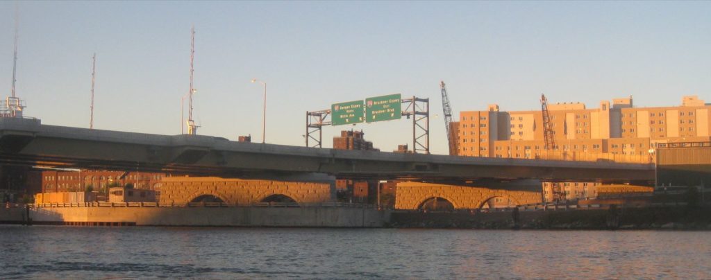
Just north of High Bridge are a pair of confusing Bridges: the Alexander Hamilton Bridge and the Washington Bridge. The Hamilton Bridge is part of the interstate highway system and feeds directly onto the George Washington Bridge; the Washington Bridge does not connect to the GWB at all; it simply connects streets in Manhattan and the Bronx, as well as to the interstate in the Bronx. This causes no amount of confusion to drivers new to the area.
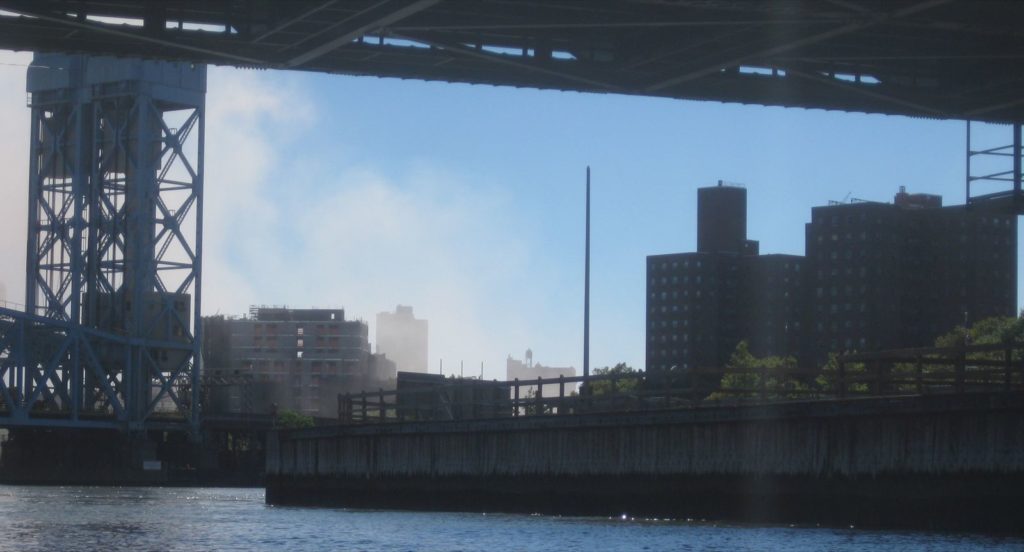
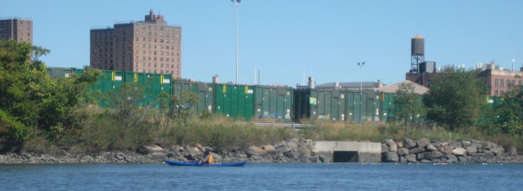
As we paddled down the Harlem, we were passed by motorboats generally moving in the opposite direction. We paddled past Roberto Clemente Park, past a a set of stairs leading up from the water, and along a set of rails that run right along the waterfront. We could see a mall that we knew was near Yankee Stadium. Near 145th street, we could make out smoke billowing out from Harlem, but it dissipated quickly.
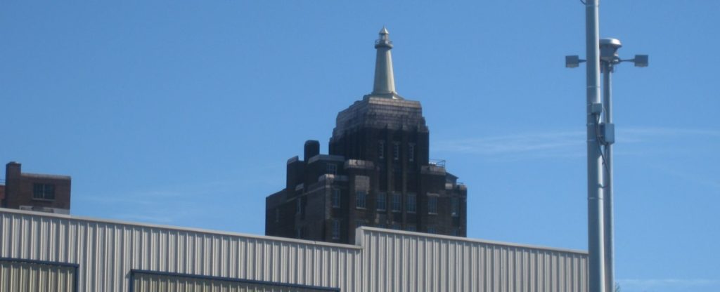
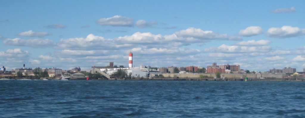
One interesting building in the Bronx has a faux lighthouse built on top; thanks to the internet, I came across the story behind it: it’s the logo for a the H. W. Wilson Company, a firm that publishes the Reader’s Guide to Periodical Literature – magazine indices.
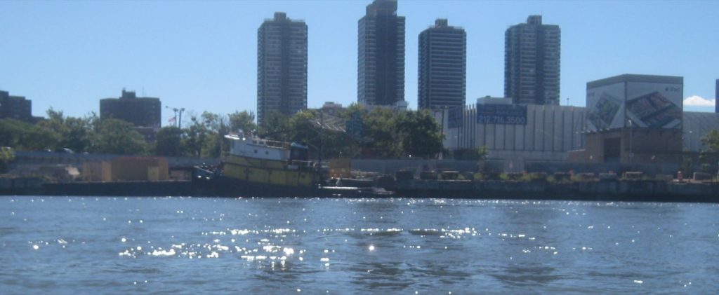
The river widened as we approached Randalls Island. A small tug was parked on the Manhattan side, and we could see some sort of NYPD boat depot on the Randalls Island side, south of the kill. We gathered together, and IB paddled ahead to the kill, to see if it was passable. He reported back that geese were standing in the water.
We all went to check. The water was no deeper than the length of my hand – straight down, with my fingers touching the sandy bottom, my wrist was at the waterline. Furthermore, the water barely trickled over some rocks. Would we make it over without damaging our boats?
AA went over first. In a plastic boat, he had much less to worry about as far as scratches to the hull. He was followed in short order by MH in his canoe, and LL in his plastic boat. They reported back, at worst, a couple of taps as they flowed over. “Just like the Titanic,” I said. I gave it a shot, and made it over with no scraping at all.
MD and IB were in boats with very thin skins, so they got out of their boats, in shin-deep water, floated them over, and then climbed back in on the other side.
We continued our journey, looking down into the water to avoid obstacles. There were plenty of big rocks to avoid.
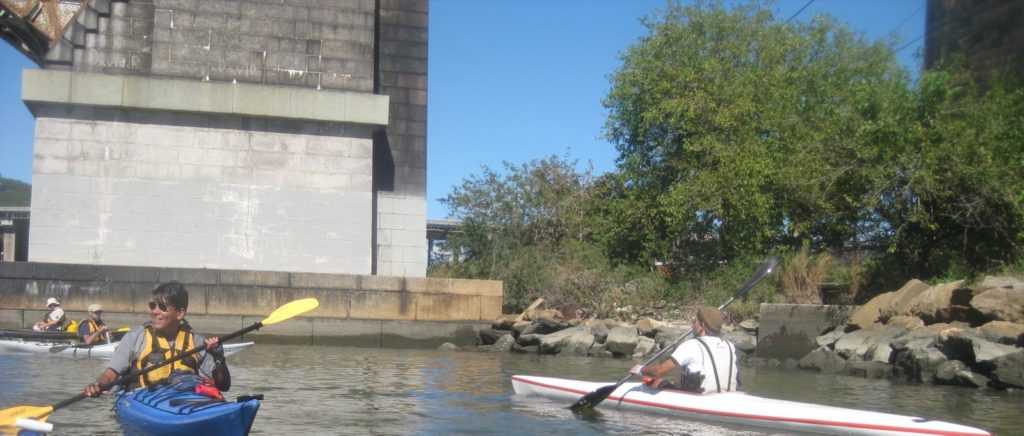
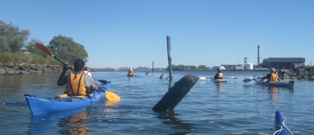
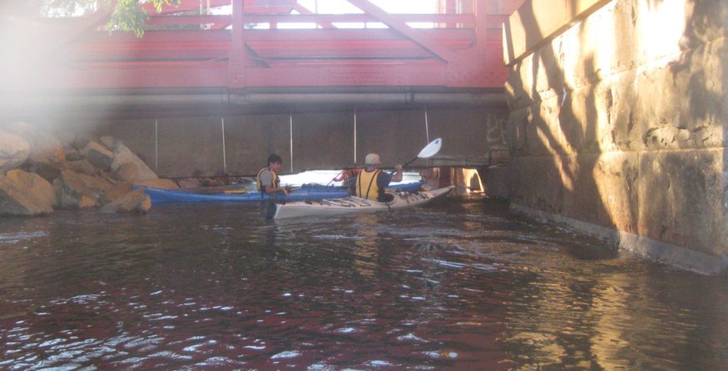
Eventually we came to an obstacle that we had anticipated: the Con Ed (Consolidated Edison, the local power company) conduit. Basically, a highway, with a railway below it and now a pedestrian bridge below that. Additionally, there are some power cables that extend across the kill. Furthermore, there was some scaffolding hanging from those pipes, making for a very narrow space between the lower edge and the water.
None of that was a problem however. The problem was that the water trickled over a rocky ledge. There was no way we were going to make it over. We’d run out of road.
We got out and quickly found a path over to the other side, and decided to portage our boats. Rather than carry the boats up and over, we simply handed them over across the ledge. While we couldn’t paddle it, there was space to pass the boats through by lifting them. A few minutes of an old-fashioned GI loading line, and we were off, re-launching at the end of the kill, facing out to the East River.
Now, when I refer to the East River here, I might as well call it the far upper East River, because we were in the part that extends from Long Island Sound before it gets to Manhattan. This was completely new territory for me. While Randalls Island is administratively part of Manhattan, it’s hard to take that seriously when the Bronx is on your left and Queens is to your right. We could see planes taking off from LaGuardia, and later, could make out the fences and buses of Rikers Island, the city’s main prison.
Directly before us was South Brother Island. I was surprised at how close it was. We would be there in no time.
We looked both ways for large vessels, knowing we would be crossing a shipping channel. We were clear, and started a ferry crossing – so called because you paddle your boat on a given heading with the expectation that the current will carry you in part along a different course. With the strong ebb current flowing west, we aimed slightly northeast, and passed along the south side of South Brother Island. We saw some beautiful heron flying in and out, and after passing the island were perfectly positioned to paddle north, counter-clockwise around North Brother Island, the larger and (to me, historically) more interesting of the two.
North Brother Island is, in my opinion, the most tragic island in New York City. It has served several purposes and been home to at least one major nautical disaster. Notably, it was where Typhoid Mary was forcibly quarantined by the city on two separate occasions, the second time being for the remainder of her life. In the middle of the 20th century, it was also where the city would send drug addicts for recovery, locking them in rooms until they were clean.
About the only good use was as a manned lighthouse station – but even at that, one of the lighthouse keepers went in to the city one day and disappeared, leaving his brother in charge.
In 1904, the General Slocum, a passenger steamboat carrying 1300 people set out for Long Island, carrying mostly German immigrants, mostly moms and kids, out for a picnic cruise. As it made its way up the East River, a fire started and quickly spread throughout the ship. Many people died by drowning, owing in part to rotted and useless life-jackets, along with the fact that most people did not know how to swim back then. The ship ran aground at North Brother Island, followed by many bodies of its former passengers. Over a thousand people died, making it the most fatal incident in NYC prior to the attacks on the World Trade Center nearly a century later, and rivaling the Titanic’s death toll less than a decade later.
The effect on the German community in the Lower East Side was devastating, and many families relocated to other parts of the city.
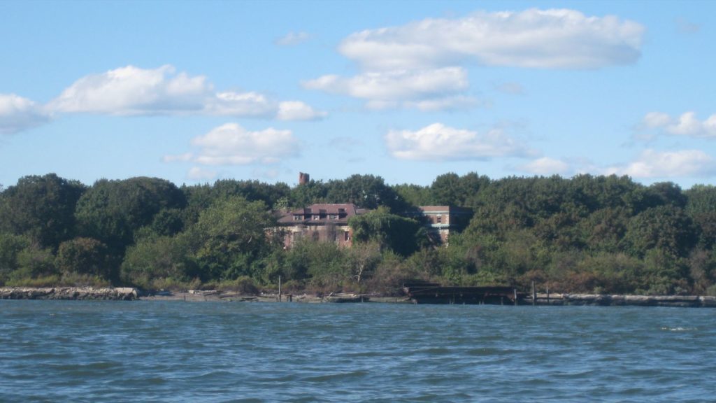
So, North Brother Island: a place of quarantine, disease, addiction, and death. It’s now a wildlife sanctuary, and humans are not allowed during nesting season. Yet, the ruins of the old hospital still stand, including the power plant with its still-visible smoke stack, the morgue, the hospital proper, and an old ferry dock on the west edge of the island.
As we paddled around, we aimed for the Bronx, keeping some distance as it’s partly a security zone – understandable as there are some large fuel tanks there, which might make tempting targets for maliciously-minded miscreants. By this time, the tide was flooding back in from the sound, and we quickly found ourselves back by the kill. While we had hoped to paddle further south through Hell Gate, we were running later than we had hoped, and so decided to paddle back through the kill instead.
Now we faced a different challenge. The rising water level made our previous portage spot navigable, but the higher water made the clearance under those pipes lower. Furthermore, while we could move our boats through, the incoming current was moving very fast, and when combined with a number of other obstructions, some strong eddies formed that required some sophisticated technique in order to thread the needle through to the the other side. Altogether, we spent at least half an hour trying to get our boats through, and even at that, half of us portaged the boats again.
Once through, we enjoyed a nice steady current back to the Harlem. When we came to the site of our earlier rapids, there was more than enough clearance for all the boats, and the current flowed the opposite direction. A couple of people stayed to play in the minor rapids, while the rest paddled on.
As we paddled past High Bridge, we decided it was getting dark enough to warrant putting lights on. We tend to favor LED lights. I have one tied to the aft end of my boat, and another on my PFD, with red and green running lights up afore. Others have different arrangements. We were fortunate that the Harlem had almost no traffic that night, giving us a smooth, quiet night paddle back.
We spotted a family fishing in the river and said hello. A couple of guys further up were just sitting on the shore, sharing a couple of beers, and repeatedly commended us on what appeared to be a fun activity. A breeze cooled us down, not quite enough to warrant the trouble of pulling out our jackets, but cool nonetheless. We passed the Broadway Bridge, the Henry Hudson Bridge, and the railroad bridge, all lit up, traffic passing over them, contrasting with the crickets and other nocturnal critter sounds as we passed Inwood Hill Park.
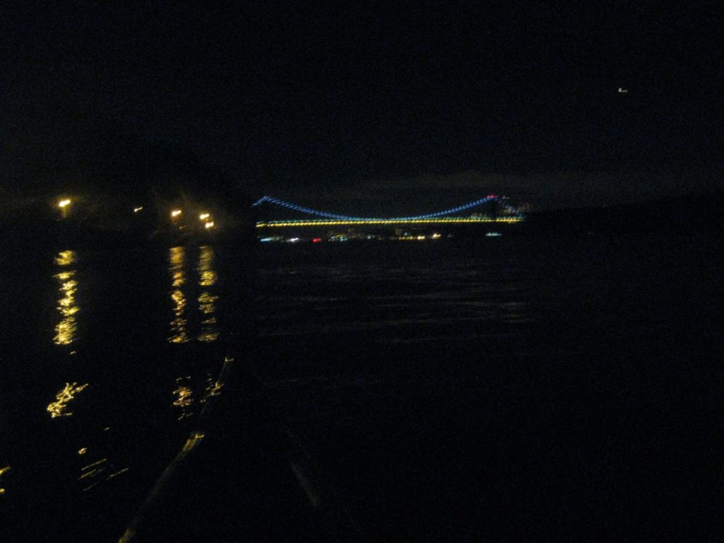
Out we went into the Hudson. At night, the sky glows a brighter shade of black over the Palisades, and the GWB is a gateway of lights, behind which the rest of the city hides. It was quiet, and the water was smooth as we paddled back to the clubhouse.
When we landed, we pulled out our boats and washed them down, talking about the trip. Everyone agreed it was a good trip. There were no major mishaps, and the timing worked out well.
I for one was glad to make it to one of my goal destinations sooner rather than later. I got to see a part of the waterfront that is out of the way, and experience a few things that I haven’t gotten to before – portage and back-ferry paddle among them. I enjoyed it a great deal, learned a lot, and had good company. That’s about as good as it gets.
Read about the preservation history by the NYC Parks Department, as well as the lighthouse operation. A photojournalist wrote about a more adventurous series of visits.
[…] controlled by NYC Parks, and landing at either is forbidden. I’ve paddled this way before, in a group and in warmer times, when I was less experienced. It’s a fun […]